Table of Contents
- Overview
- Key Features
- How It Works
- Use Cases
- Pros and Cons
- Pricing
- How Does It Compare?
- vs. Procore (Construction Management Platform)
- vs. Fieldwire by Hilti (Field Management Platform)
- vs. OpenSpace (360° Documentation Specialist)
- vs. CompanyCam (Photo App for Contractors)
- vs. PlanRadar (Issue \& Task Management with Photo Documentation)
- vs. Generic Cloud Storage (Google Drive, Dropbox, OneDrive)
- Key Differentiators
- Final Thoughts
- Major Corrections Summary
Overview
Filio is an AI-powered construction photo documentation platform launched on Product Hunt in December 2025 that transforms jobsite visual assets into searchable, report-ready evidence for construction, engineering, contracting, and inspection teams. Founded by Georgia Tech PhD researchers Max Roozbahani and Fikret Atalay, Filio emerged from the prestigious Create-X startup incubator program beginning in 2019 with a mission to solve the chronic challenges of construction site documentation: inconsistent coverage, variable quality, cumbersome data management, and time-consuming report generation.
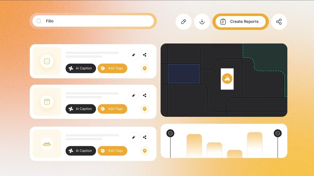
Field teams use the mobile Filio Data Collector app to capture photos, videos, 360-degree panoramas, document scans, and measured visuals, then pin them directly onto plan sheets, floorplans, blueprints, or GIS map layers. The platform automatically preserves comprehensive metadata including GPS coordinates, date/time stamps, camera bearing and elevation, and local weather conditions at the moment of capture. Filio’s AI engine then enhances each asset with intelligent captions, descriptive labels, custom tags, and searchable fields that make finding specific images instant rather than requiring manual scrolling through thousands of files.
In the web console dashboard, project managers, office teams, and external stakeholders control granular permissions, collaborate through annotations and comments, review documentation via intuitive timelines and map-based presentations, and generate professional PDF and Word reports with customizable templates. This comprehensive approach elevates construction photo documentation from chaotic file folders into structured, searchable intelligence that supports progress tracking, quality assurance, dispute resolution, and client communication.
Key Features
Mobile Data Collector App with Cloud Sync: The Filio Data Collector mobile application, available for iOS and Android, provides field teams with comprehensive capture capabilities optimized for jobsite conditions. The app automatically uploads all assets to cloud storage with intelligent queueing that handles intermittent connectivity, ensuring documentation never gets lost due to network issues. Multi-photo capture mode, timer-based scheduling for consistent interval documentation, and integration with 360-degree cameras (Ricoh Theta, Insta360) enable efficient, thorough site coverage without requiring technical expertise.
AI Insights with Automatic Tagging and Captioning: Filio’s computer vision and natural language processing analyze every uploaded image, automatically generating descriptive tags, detailed captions, and metadata fields that make assets instantly searchable. The system identifies construction elements like framing, electrical, plumbing, HVAC systems, site conditions, safety equipment, and materials visible in images, then applies structured tags enabling filtering by trade, location, date range, or custom attributes. This AI-powered organization transforms weeks of manual photo sorting into seconds of intelligent search.
Comprehensive Cloud Integration: Seamlessly sync captured photos and videos with existing cloud storage infrastructure including Google Drive, Dropbox, and Microsoft OneDrive. This integration enables backup redundancy, facilitates collaboration with external consultants using their preferred platforms, and ensures documentation remains accessible even if direct Filio access is unavailable. Bidirectional synchronization means files added to connected cloud folders automatically appear in Filio projects with appropriate metadata.
Floorplans, Blueprints, and GIS Map Layers: Pin photos, videos, and annotations directly onto uploaded architectural drawings, site plans, and geographic information system (GIS) maps. The platform supports industry-standard formats including PDF plans, CAD files, KML/KMZ geographic layers, and GeoJSON data. This spatial pinning creates visual relationships between documentation and physical locations, enabling stakeholders to understand exactly where on site each photo was captured without reading GPS coordinates or descriptions.
Customizable Dynamic Report Generation: Create professional PDF and Word reports with drag-and-drop templates supporting both portrait and landscape layouts. Reports automatically populate with selected photos, timeline data, map visualizations, project metadata, custom text blocks, and company branding. Template systems enable repeatable report structures for weekly progress updates, client deliverables, inspection documentation, or punch list reviews, ensuring consistent formatting and comprehensive coverage without manual assembly.
On-Site Rich Media Capture: Beyond standard photos, Filio supports comprehensive visual documentation including HD video (up to 10 minutes per clip), 360-degree panoramic photography for immersive site views, object measurement tools that calculate dimensions directly from photos, AI-powered voice-to-text notes captured even in noisy construction environments, document scanning for capturing site paperwork and submittals, and timer-based automated capture for consistent time-lapse documentation.
Geospatial Metadata Preservation: Every captured asset automatically embeds GPS coordinates pinpointing exact capture location, date and time stamps for temporal tracking, camera bearing indicating the direction the device was facing, elevation data for multi-level structures, and weather conditions including temperature, precipitation, and wind at capture moment. This rich contextual data ensures complete chain-of-custody documentation valuable for legal, insurance, and compliance scenarios.
Advanced Search in Metadata, Maps, and Timelines: Find specific photos instantly by searching across AI-generated captions, user-added tags, voice-to-text notes, GPS locations, date ranges, weather conditions, custom fields, or file names. The timeline view presents all documentation chronologically with filtering by date, user, or asset type. Map-based search enables finding all photos captured within defined geographic boundaries, perfect for large sites with multiple buildings or extensive infrastructure projects.
Granular Permission Controls and Stakeholder Sharing: Manage project access with role-based permissions differentiating Data Collectors (field capture), Project Administrators (full management control), Viewers (read-only access), and custom roles with granular capability restrictions. External stakeholders including clients, architects, inspectors, or subcontractors can receive secure sharing links providing temporary access to specific documentation without requiring full Filio accounts or login credentials.
Real-Time Collaboration Tools: Team members add annotations directly onto plan sheets, floorplans, or photos, highlighting specific areas requiring attention. Comments thread beneath assets enabling discussions about observations, quality issues, or required corrections. Notifications alert relevant team members when new documentation is added, comments are posted, or reports are generated, keeping everyone synchronized across office and field locations.
GIS Export and Data Portability: Export complete project documentation with embedded geospatial metadata in industry-standard GIS formats enabling integration with surveying software, municipal planning systems, environmental monitoring platforms, or civil engineering analysis tools. CSV metadata exports and bulk ZIP downloads with personalized file naming conventions ensure documentation remains accessible even if transitioning away from Filio.
Document Scanning and Centralized Asset Management: Capture site paperwork, material delivery receipts, inspection forms, safety documentation, and submittals directly through the mobile app using document scanning functionality. All project assets—photos, videos, 360 panoramas, documents, and notes—centralize in a unified repository eliminating the fragmentation typical of construction projects where visual documentation, paperwork, and communications scatter across emails, shared drives, and local devices.
How It Works
Field Documentation Workflow
Field teams begin by installing the Filio Data Collector mobile app on iOS or Android devices. After logging into their assigned project, the app displays uploaded floorplans, blueprints, and map layers for the site. As workers walk the jobsite, they capture photos, videos, or 360 panoramas of construction progress, quality issues, safety conditions, deliveries, or any documentation-worthy observations.
The app automatically embeds GPS coordinates, timestamps, camera orientation, elevation, and weather data into each asset’s metadata. Workers add context through voice-to-text notes captured hands-free even in noisy environments—the AI transcription accurately converts speech to text for future searchability. For precise documentation, the object measurement tool calculates dimensions of elements visible in photos, eliminating the need for separate measuring devices.
Assets pin directly onto plan sheets or maps, creating spatial relationships between documentation and physical locations. Field teams select the relevant drawing, tap the approximate location, and attach the photo or video. This georeferencing happens automatically via GPS for outdoor captures or manually via plan sheet selection for interior work.
All captured documentation uploads continuously to cloud storage as network connectivity allows. The intelligent queue system handles intermittent cellular signals common on construction sites, automatically resuming uploads when connection restores. This background synchronization ensures office teams see new documentation within minutes of field capture without requiring field workers to manually trigger uploads.
Office Review and Management
Project managers and office teams access the web console dashboard via browser, where all synchronized field documentation appears in timeline, map, and plan sheet views. The timeline presents chronological documentation history with filtering by date range, user, asset type, or custom tags. The map view displays geotagged photos and videos overlaid on site boundaries, revealing spatial distribution of documentation and identifying under-documented areas.
Filio’s AI engine processes uploaded assets, generating descriptive captions and searchable tags. For example, a photo showing electrical conduit installation might automatically receive tags like “electrical,” “rough-in,” “conduit,” “second floor,” and captions describing visible details. Users refine AI-generated metadata by adding project-specific custom fields, adjusting tags, or appending additional notes.
The advanced search functionality enables finding specific documentation instantly. Queries like “plumbing inspections last week,” “safety violations,” “concrete pour third floor,” or “delivered materials rain” return relevant assets in seconds, transforming cumbersome manual photo review into efficient targeted retrieval.
Team members collaborate by adding annotations directly onto plan sheets or photos, highlighting areas requiring attention, correction, or follow-up. Comment threads beneath assets facilitate discussions among field supervisors, quality managers, subcontractors, and office staff without requiring separate email chains or text message conversations that fragment project communications.
Report Generation and Stakeholder Communication
When project milestones arrive—weekly progress updates, monthly client reports, inspection documentation, or final deliverables—office teams generate professional reports through Filio’s customizable template system. The drag-and-drop interface allows selecting which photos, videos, maps, timelines, and data fields populate report sections. Portrait and landscape layout options accommodate different presentation preferences and printing requirements.
Report templates save for future reuse, ensuring consistent structure across reporting periods. Weekly progress reports automatically pull documentation from the past seven days, overlay photos onto relevant plan sheets, include weather condition summaries, and populate contractor notes—all without manual assembly. Custom branding adds company logos, color schemes, and formatting that match corporate identity standards.
Generated PDF and Word reports export for distribution via email, project management platforms, or client portals. For external stakeholders without Filio access, secure sharing links provide temporary view-only access to specific project documentation without requiring account creation or login credentials. Permissions control exactly which assets, dates, or locations each external party can access, maintaining confidentiality while enabling necessary transparency.
Use Cases
Construction and General Contractor Photo Logs: General contractors managing complex multi-trade projects leverage Filio to centralize documentation from superintendents, project managers, safety officers, and quality inspectors. The timeline view provides comprehensive project history for schedule tracking, while map-based documentation reveals spatial progress across large sites. AI tagging enables filtering photos by trade (electrical, plumbing, HVAC, framing), expediting punch list creation and subcontractor coordination.
Engineering Firms and Site Evidence: Civil, structural, and geotechnical engineers conducting site investigations, construction observations, or forensic assessments use Filio to capture georeferenced photographic evidence with comprehensive metadata. GPS coordinates, elevation data, weather conditions, and timestamps provide rigorous chain-of-custody documentation supporting expert reports, litigation support, or regulatory compliance. Integration with GIS systems enables overlaying photographic documentation onto survey data and engineering plans.
Large Site and Infrastructure Map-Based Documentation: Highway construction, utility installations, pipeline projects, solar farms, and other geographically extensive infrastructure projects benefit from Filio’s map-centric approach. Crews document progress across miles of alignment by geotagging photos to GIS layers showing project stationing, parcels, or geographic features. Office teams review spatial documentation coverage, identify under-documented segments, and generate linear progress reports showing work completion along project routes.
Inspection and Quality Assurance: Building inspectors, code enforcement officers, and third-party quality auditors use Filio to standardize inspection documentation. Timer-based capture ensures consistent interval photography throughout inspections. Voice-to-text notes allow hands-free recording of observations while simultaneously photographing. Generated reports with embedded photos and GPS data provide defensible inspection records supporting regulatory compliance, contractor dispute resolution, or insurance claims.
Repeatable Client Reporting with Consistent Formatting: Construction firms serving repeat clients (retail chains, property developers, municipal agencies) use Filio’s template system to maintain consistent report formatting across all projects. Templates standardize photo layouts, progress descriptions, and branding, ensuring every client deliverable maintains professional quality without requiring custom design work. AI-powered auto-population reduces report generation time from hours to minutes while eliminating transcription errors.
Environmental and Water Resources Management: Environmental consultants, stormwater inspectors, and water utility teams document site conditions, erosion controls, wetland monitoring, and infrastructure installations using Filio’s geospatial capabilities. GPS-tagged photos overlaid onto environmental assessment boundaries or watershed maps provide spatial documentation supporting permit compliance, environmental impact assessments, and habitat monitoring programs.
Insurance and Forensic Engineering: Property insurance adjusters and forensic engineers investigating construction defects, disasters, or casualty losses use Filio to create comprehensive photographic records with defensible metadata. Timestamped, geotagged photos with weather condition data provide crucial evidence for claims documentation, expert reports, or litigation support. The platform’s searchability enables quickly locating specific photographic evidence among thousands of images collected across multiple site visits.
Pros and Cons
Advantages
Construction-Specific Features Beyond Generic Cloud Storage: Unlike Google Drive, Dropbox, or consumer photo apps that treat construction documentation as generic files, Filio provides purpose-built capabilities addressing construction workflow realities: pinning photos to plan sheets and maps, embedding geospatial and weather metadata, AI-powered trade-specific tagging, and report templates matching construction deliverable expectations. This specialization eliminates the improvised workarounds and manual organization burden that generic cloud storage requires.
AI Tagging Dramatically Improves Searchability: The automatic generation of descriptive captions and structured tags transforms chaotic photo collections into searchable databases. Finding all electrical rough-in photos, safety violations, concrete pours during rain, or delivered materials from specific dates becomes instantaneous rather than requiring manual review of thousands of chronologically-organized files. This search efficiency compounds over project lifetimes, saving hours of documentation review time during punch lists, inspections, or dispute resolution.
Geospatial Metadata Provides Legal-Grade Documentation Chain-of-Custody: The automatic capture of GPS coordinates, timestamps, camera bearing, elevation, and weather conditions creates defensible documentation meeting evidentiary standards for litigation, insurance claims, or regulatory compliance. This metadata richness surpasses consumer photo apps that capture only basic EXIF data, providing context crucial for establishing when, where, and under what conditions specific observations were made.
Repeatable Professional Report Generation: The drag-and-drop template system with customizable layouts dramatically reduces report generation time from hours of manual assembly in Word or PowerPoint to minutes of automated population. Consistent formatting across reporting periods projects professionalism and attention to detail that strengthens client relationships and supports premium pricing. The ability to generate multiple report variants (executive summary, detailed technical, client-facing) from the same documentation set eliminates duplicate effort.
Comprehensive Cloud Integration Enables Hybrid Workflows: The bidirectional synchronization with Google Drive, Dropbox, and OneDrive respects existing organizational infrastructure investments and workflows. Teams can continue using familiar cloud platforms while gaining Filio’s specialized construction features without forcing complete platform migration. This flexibility accelerates adoption by reducing organizational change resistance.
Unlimited Web Console Accounts with Data Collector Seat Pricing: The pricing model charges only for field teams actively capturing documentation while providing unlimited free access for office staff, project managers, executives, clients, and external stakeholders reviewing documentation. This structure aligns costs with value delivery—organizations pay for documentation creation capacity while enabling unlimited collaboration and review without per-user seat charges that constrain stakeholder access.
Founded by Construction Technology PhD Researchers: The leadership team’s academic research background in computational civil engineering and AI applications in construction demonstrates deep domain expertise beyond typical software-as-a-service ventures. This technical credibility lends confidence that product development prioritizes solving genuine construction challenges rather than superficially applying generic technology to niche markets.
Disadvantages
Seat-Based Pricing for Data Collector Roles Can Escalate Costs: While unlimited Web Console accounts reduce office overhead, organizations with large field teams face linear cost scaling at \$25 per Data Collector per month. A contractor with 20 field personnel capturing documentation incurs \$500 monthly (\$6,000 annually) in subscription costs. For price-sensitive small contractors or projects with tight margins, this recurring expense may prove prohibitive compared to free-to-start competitors or consumer photo apps.
Learning Curve for Field Teams Unfamiliar with Specialized Software: Workers accustomed to simply taking phone photos and uploading to Google Drive must learn Filio’s plan sheet pinning, voice-to-text notation, and structured capture workflows. This training overhead and initial productivity dip during adoption can create field resistance, particularly among less tech-savvy workers or subcontractors participating temporarily on single projects.
Requires Mobile Device Investment and Connectivity: Effective field documentation requires smartphones or tablets with GPS capability, decent cameras, and cellular data or WiFi connectivity. Organizations with workers using basic feature phones or operating in remote areas without reliable network coverage may face infrastructure investment or operational limitations. While the app’s intelligent queuing handles intermittent connectivity, complete offline operation for extended periods isn’t explicitly documented.
AI Tagging Accuracy Depends on Image Quality and Context: Computer vision systems struggle with poor lighting, obstructed views, unusual angles, or highly specialized equipment unfamiliar to training datasets. AI-generated tags and captions require human review and correction to ensure accuracy, particularly for non-standard conditions or proprietary systems. Organizations expecting fully autonomous intelligent organization may find the AI assists but doesn’t eliminate human metadata curation entirely.
Limited Free Tier Visibility: Unlike competitors offering free plans for individual users or small teams, Filio’s pricing information focuses on Data Collector seat costs without prominently advertising free tier availability or limitations. Organizations wanting extended evaluation before financial commitment may lack clarity about trial duration, feature restrictions, or documentation volume caps during evaluation periods.
Newer Platform with Smaller Market Share Than Established Leaders: Despite launching from Georgia Tech’s incubator in 2019 and achieving Product Hunt visibility in December 2025, Filio competes against well-established construction software giants (Procore, Autodesk) and photo-documentation specialists (CompanyCam, OpenSpace) with larger customer bases, integration ecosystems, and feature maturity. Risk-averse organizations may prefer platforms with extensive peer references, comprehensive third-party integrations, and proven multi-year operational stability.
Pricing
Filio One Plan: Per Data Collector Seat: The platform’s pricing model charges exclusively for Data Collector mobile app accounts that field teams use to capture and upload documentation. Pricing tiers include monthly billing at \$25 per Data Collector seat per month, or annual billing at \$240 per Data Collector seat per year (equivalent to \$20 per month with annual commitment, representing 20% savings).
Unlimited Web Console Accounts Included: Every Filio One subscription includes unlimited Web Console accounts at no additional cost for office staff, project managers, executives, clients, subcontractors, architects, inspectors, and any other stakeholders who need to review, search, collaborate on, or report from captured documentation. This structure eliminates common SaaS pricing friction where adding collaboration participants triggers escalating per-seat charges.
Complete Feature Access: All Data Collector seats include comprehensive capabilities with no feature-tier restrictions: unlimited photos, videos, 360 panoramas, document scans; AI-powered tagging, captions, and voice-to-text; plan sheet, floorplan, blueprint, and GIS map pinning; customizable PDF and Word report generation; cloud integration with Google Drive, Dropbox, OneDrive; advanced search across all metadata fields; geospatial data export; team collaboration tools; and granular permission controls.
Filio Enterprise: Custom Deployment: Organizations requiring flexible commercial terms, large-scale deployment, custom procurement workflows, volume-based pricing negotiations, dedicated account management, implementation assistance, or specialized contractual requirements can contact sales for Enterprise arrangements. Enterprise maintains the same Data Collector seat-based billing structure with customized pricing reflecting deployment scale and contract terms.
No Hidden Usage Fees: Unlike platforms charging separately for storage capacity, API calls, report generation, external sharing, or data exports, Filio’s Data Collector seat pricing includes unlimited usage of all platform capabilities without metered consumption fees or surprise overage charges.
Cost Comparison Context: Construction photo documentation alternatives span dramatic price ranges: Consumer approaches using Google Photos and Drive folders cost \$0 but provide zero construction-specific features. Specialist photo platforms like CompanyCam charge \$79-199 per month for 3-user teams. Enterprise construction management suites like Procore cost thousands monthly. Filio positions at \$20-25 per Data Collector with unlimited collaboration accounts, occupying the mid-range niche between consumer improvisation and enterprise-scale platforms.
How Does It Compare?
Filio occupies a specialized niche as a construction-focused visual asset management platform emphasizing geospatial intelligence and AI-powered organization. Here’s how it compares to major alternatives:
vs. Procore (Construction Management Platform)
Scope: Procore provides comprehensive construction project management spanning estimating, bidding, contracts, scheduling, resource management, cost control, quality/safety, and documentation. Filio focuses exclusively on visual asset management with photo documentation, report generation, and intelligent organization as core capabilities.
Photo Documentation Features: Procore includes photo management as one module within its broader platform, with features like drawing markups, QR code generation, and OCR-based drawing organization. Filio makes photo documentation the central product focus with specialized AI tagging, voice-to-text notes, 360 panorama support, and customizable report templates purpose-built for visual deliverables.
Pricing: Procore operates on enterprise-scale pricing requiring customized quotes, generally costing thousands of dollars monthly for comprehensive feature access and serving larger contractors. Filio charges \$20-25 per Data Collector seat monthly with unlimited Web Console accounts, targeting smaller to mid-sized contractors and specialty trades.
Best For: Use Procore for comprehensive enterprise construction management requiring integrated cost, schedule, and quality systems. Choose Filio for specialized visual documentation needs when photo management, geospatial organization, and report generation are primary requirements without requiring full project management suites.
vs. Fieldwire by Hilti (Field Management Platform)
Primary Focus: Fieldwire emphasizes field task management, punch lists, plan viewing, RFIs, submittals, and change orders with photo documentation supporting these workflows. Filio emphasizes photo documentation as the primary deliverable with tasks and project management secondary.
Photo Features: Fieldwire enables attaching photos to tasks, plans, and punch list items with basic organization and sharing. Filio provides AI-powered tagging, voice-to-text captions, 360 panorama support, geospatial intelligence, and advanced report generation specifically for visual deliverables.
Pricing: Fieldwire charges \$39-89 per user per month depending on feature tier (Pro, Business, Business Plus). Filio charges \$20-25 per Data Collector with unlimited free Web Console accounts, potentially lower cost for organizations with many reviewers relative to field documentation captureers.
Best For: Use Fieldwire for integrated field task management where photo documentation supports punch lists and RFI workflows. Choose Filio when visual documentation itself is the primary deliverable requiring sophisticated organization, AI intelligence, and professional report generation.
vs. OpenSpace (360° Documentation Specialist)
Capture Technology: OpenSpace specializes in automated 360-degree photo capture that maps imagery onto building information models (BIM) and plan sets while users walk jobsites wearing 360 cameras. Filio supports 360 cameras (Ricoh, Insta360) alongside standard photos/videos with manual or GPS-based positioning.
Automation Level: OpenSpace automates capture-to-plan mapping through computer vision analyzing 360 footage. Filio requires users to manually pin photos to plan sheets or relies on GPS for outdoor geolocation, providing more control but requiring more manual positioning.
Use Case Specialization: OpenSpace excels for large commercial construction requiring comprehensive as-built documentation and BIM coordination. Filio suits diverse project types (infrastructure, civil, inspection, smaller commercial) where standard photos, selective documentation, and flexible report generation meet needs without requiring dedicated 360 capture workflows.
Pricing: OpenSpace pricing isn’t publicly listed but reportedly costs thousands monthly for enterprise deployments. Filio’s \$20-25 per Data Collector provides cost-accessible entry for smaller organizations.
Best For: Use OpenSpace for large commercial projects requiring automated BIM-integrated 360 documentation. Choose Filio for diverse project types, infrastructure work, civil engineering, or when standard photography with AI organization and flexible reporting suffices.
vs. CompanyCam (Photo App for Contractors)
Platform Philosophy: CompanyCam emphasizes simplicity and ease-of-use with intuitive mobile-first photo capture, automatic organization, team sharing, and basic project management. Filio emphasizes construction intelligence through geospatial data, AI tagging, plan sheet integration, and professional report generation.
Photo Organization: CompanyCam organizes photos by project, timeline, and user-created tags with @mentions and comment feeds. Filio adds AI-generated tags, voice-to-text captions, GPS/weather metadata, and plan sheet/map pinning creating spatial organization beyond chronological feeds.
Reporting: CompanyCam provides automated report generation and project timeline summaries. Filio offers customizable drag-and-drop templates with portrait/landscape layouts, plan sheet integration, and extensive branding customization for client-facing deliverables.
Pricing: CompanyCam charges \$79-199 per month for 3-user teams (Pro, Premium, Elite). Filio charges \$20-25 per individual Data Collector, potentially more economical for smaller teams or individuals.
Best For: Use CompanyCam for straightforward mobile photo sharing emphasizing team collaboration and ease-of-use. Choose Filio for sophisticated geospatial intelligence, AI organization, plan integration, and customizable professional reporting.
vs. PlanRadar (Issue \& Task Management with Photo Documentation)
Primary Function: PlanRadar focuses on defect management, issue tracking, and task assignment with photo documentation supporting these workflows. Filio focuses on visual asset management with organization, intelligence, and reporting as primary functions.
Photo Capabilities: PlanRadar enables pinning photos and issues to plan sheets with status tracking and assignee workflows. Filio provides AI tagging, voice-to-text, 360 support, comprehensive metadata, and advanced report generation without requiring issue-tracking structure.
Pricing: PlanRadar charges \$32-159 per user per month depending on tier and user count. Filio charges \$20-25 per Data Collector with unlimited Web Console accounts, structured differently to compare directly.
Best For: Use PlanRadar for defect tracking and quality management workflows requiring structured issue resolution. Choose Filio when visual documentation organization and professional reporting are primary needs without requiring formal issue-tracking systems.
vs. Generic Cloud Storage (Google Drive, Dropbox, OneDrive)
Construction Features: Generic cloud storage treats photos as undifferentiated files requiring manual folder organization, naming conventions, and spreadsheet-based tracking. Filio provides construction-specific plan sheet pinning, AI-powered trade tagging, geospatial metadata, voice-to-text notes, and report templates matching construction deliverable expectations.
Searchability: Cloud storage search relies on manually-entered filenames and folder structures. Filio’s AI generates searchable captions and tags automatically, enabling finding “electrical rough-in second floor” or “concrete pour during rain” without manual metadata entry.
Collaboration: Cloud storage provides basic file sharing and comments. Filio offers construction-specific annotations on plan sheets, permission controls by project role, stakeholder sharing without account requirements, and structured reporting for client deliverables.
Cost: Google Drive/Dropbox/OneDrive cost \$0-20 per user per month for storage capacity. Filio charges \$20-25 per Data Collector but includes construction intelligence, AI organization, and specialized features justifying incremental cost.
Best For: Use generic cloud storage for organizations with minimal construction-specific requirements accepting manual organization overhead. Choose Filio when construction intelligence, geospatial metadata, AI organization, and professional reporting justify specialized platform investment.
Key Differentiators
Filio distinguishes itself through comprehensive geospatial metadata capture (GPS, bearing, elevation, weather), AI-powered automatic tagging and captioning specific to construction trades and elements, voice-to-text notation captured hands-free in noisy jobsite environments, integration with 360-degree cameras (Ricoh, Insta360), plan sheet and GIS map-based spatial organization, customizable drag-and-drop report templates for professional client deliverables, unlimited Web Console accounts with Data Collector seat-only pricing, and PhD-level technical leadership from Georgia Tech construction technology research.
No single competitor combines all these capabilities in one platform. For construction teams prioritizing intelligent visual documentation organization, geospatial accuracy, professional reporting, and scalable collaboration without per-reviewer seat charges, Filio provides compelling value between consumer improvisation and enterprise-scale platforms.
Final Thoughts
Filio represents thoughtful application of AI and geospatial technology to genuine construction documentation pain points: finding specific photos among thousands of files, creating professional reports without hours of manual assembly, understanding spatial context of observations across large sites, and collaborating with diverse stakeholders without licensing friction. The platform’s Georgia Tech research origins and PhD technical leadership lend credibility that development prioritizes solving real construction challenges rather than superficially applying generic software patterns to niche markets.
The December 2025 Product Hunt launch with 102 upvotes demonstrates growing awareness and market validation, though Filio competes in an increasingly crowded construction technology landscape against well-established giants (Procore, Autodesk) and specialized photo platforms (CompanyCam, OpenSpace). The company’s differentiation through AI intelligence, geospatial metadata richness, and flexible reporting positions it for organizations finding enterprise platforms overkill but consumer cloud storage insufficient.
The pricing model—charging only for Data Collector field app seats while providing unlimited Web Console accounts—cleverly aligns costs with documentation creation while eliminating common collaboration barriers where adding reviewers triggers escalating per-seat fees. This structure particularly benefits organizations with lean field teams but numerous office staff, executives, clients, and external stakeholders requiring documentation access.
However, seat-based Data Collector pricing at \$20-25 per month creates linear cost scaling for organizations with large field teams. Contractors with 20+ field personnel face \$4,800-6,000 annual subscription costs that may prove prohibitive for smaller firms or low-margin projects. The lack of prominently advertised free tier or evaluation period details may slow adoption among price-sensitive prospects wanting extended trials before commitment.
The AI tagging and captioning features deliver genuine value by automating tedious metadata creation, but organizations should calibrate expectations appropriately—computer vision assists but doesn’t eliminate human curation entirely, particularly for specialized equipment, non-standard conditions, or highly technical installations requiring domain expertise to interpret correctly.
For civil engineers, infrastructure contractors, environmental consultants, and inspection firms prioritizing geospatial accuracy and outdoor documentation, Filio’s comprehensive GPS, elevation, bearing, and weather metadata provides legal-grade chain-of-custody documentation supporting expert reports, regulatory compliance, and litigation support. This capability exceeds consumer photo apps and even some specialized competitors lacking equivalent metadata richness.
The customizable report generation with drag-and-drop templates addresses a universal construction frustration—assembling professional client deliverables from scattered documentation—and transforms multi-hour manual processes into minutes of automated population. For firms producing recurring progress reports, inspection documentation, or client updates, this efficiency gain alone may justify platform investment.
As Filio matures beyond its December 2025 launch, expanding integrations with construction management platforms (Procore, Autodesk Build), estimating tools (PlanSwift, Bluebeam), and accounting systems (QuickBooks, Sage) would strengthen workflow continuity. Building reference customer showcases across diverse project types—commercial construction, civil infrastructure, environmental consulting, municipal inspection—would accelerate adoption by reducing perceived risk and demonstrating broad applicability.
For construction teams frustrated by chaotic photo documentation, spending excessive time generating reports, requiring geospatial intelligence for infrastructure projects, or wanting AI-powered organization without enterprise-scale pricing, Filio merits serious evaluation. The specialized construction features, intelligent automation, and flexible collaboration model address genuine workflow pain points that generic cloud storage can’t match and enterprise platforms over-engineer.
Major Corrections Summary
- Product Hunt launch added: December 23, 2025 with 102 upvotes
- Company history documented: Founded by Georgia Tech PhD researchers from Create-X incubator since 2019
- Founders identified: Max Roozbahani (PhD, Founder/President/CTO) and Fikret Atalay (co-founder)
- 360 camera support specified: Ricoh Theta and Insta360 confirmed
- Video limitations: 10 minutes maximum per clip documented
- GIS formats: KML, KMZ, GeoJSON layer support verified
- Comprehensive competitive analysis: Structured comparisons with Procore, Fieldwire, OpenSpace, CompanyCam, PlanRadar, and generic cloud storage
- Pricing model clarified: Data Collector seat-only billing with unlimited free Web Console accounts
- Annual discount: 20% savings with annual billing (\$240/year = \$20/month vs. \$25/month monthly)
- Enterprise option: Custom pricing available for large-scale deployment and flexible commercial terms